GPS Tracking Software Focused on Quick Setup and Ease of Use
An ideal solution for small businesses and service providers in the telematics industry
Start to Use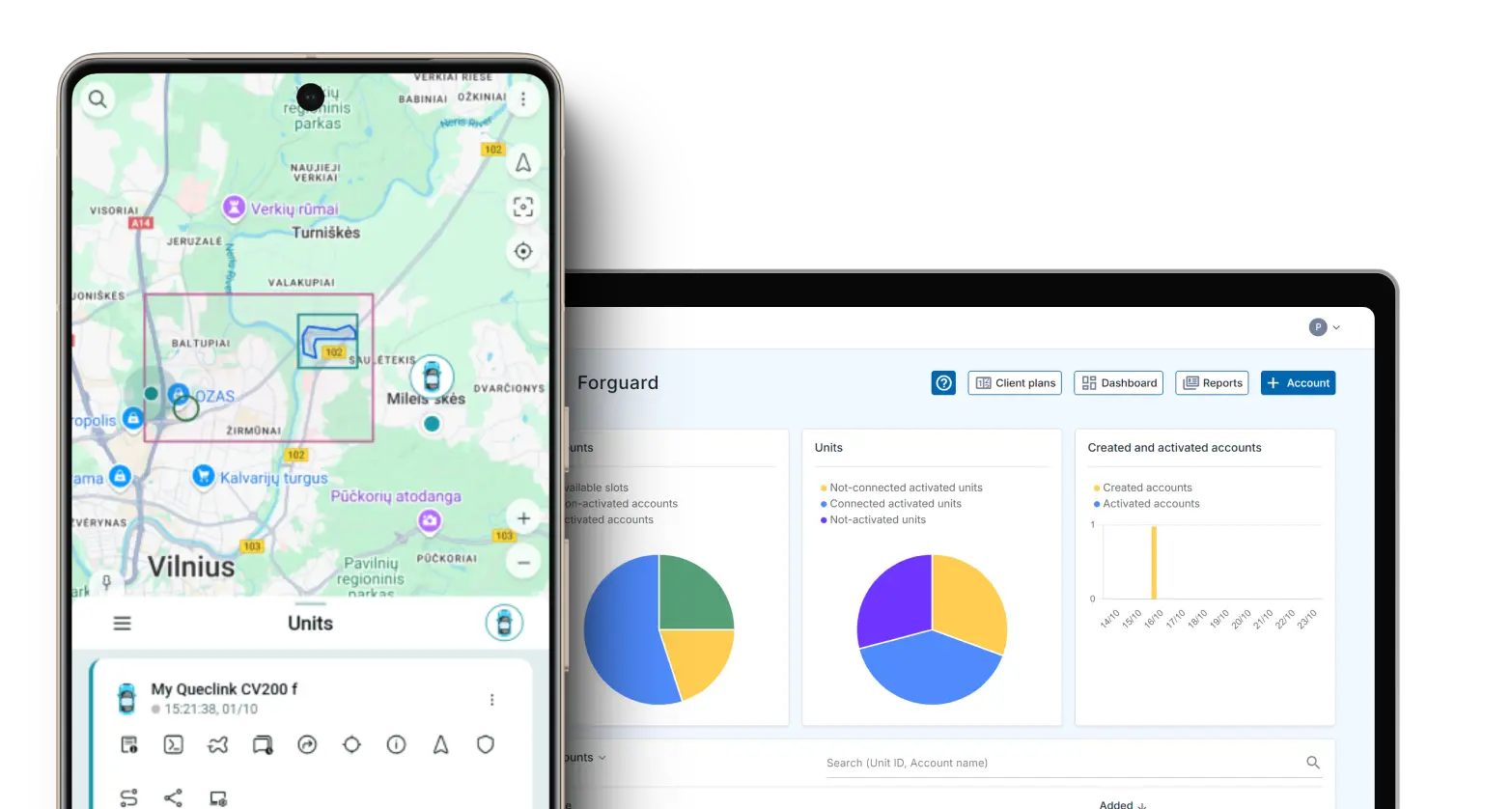
GPS Tracking Software Features
Take control of vehicle's security with our solutions
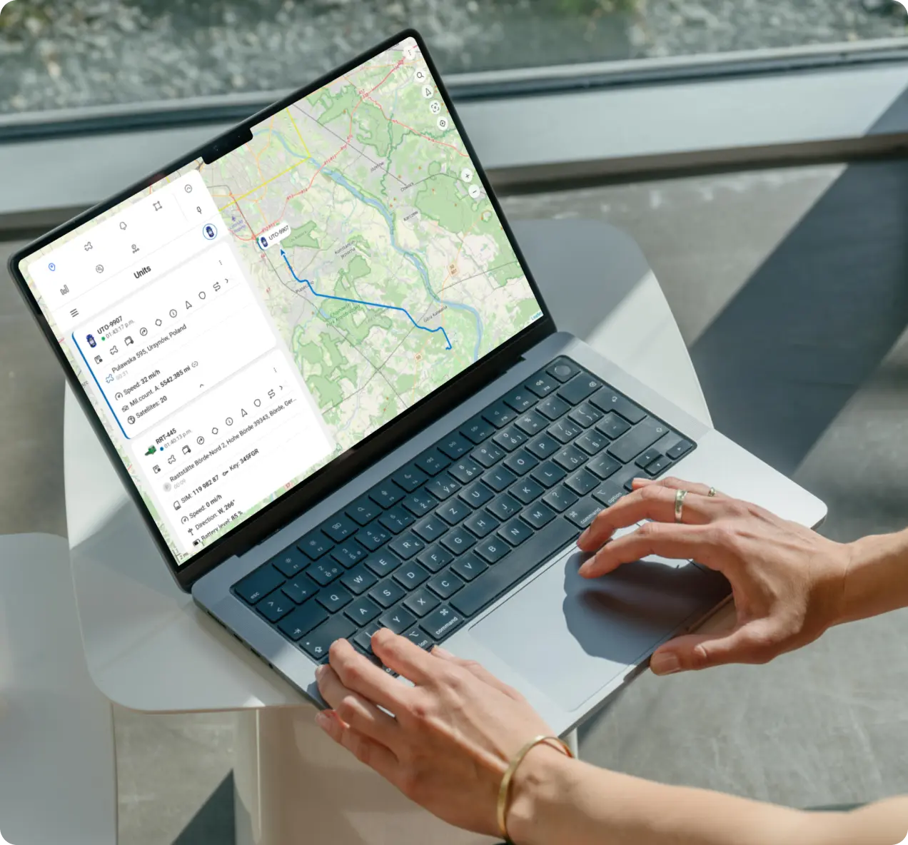
Real-time Tracking
Track vehicles in real-time with our GPS tracking solutions. View locations directly on the map in live mode, ensuring constant awareness of exact whereabouts.
Notifications and alerts
Stay updated on your vehicle's status with customized notifications and alerts.
Location Sharing
Simply generate a special link and share your vehicle's location securely with others.
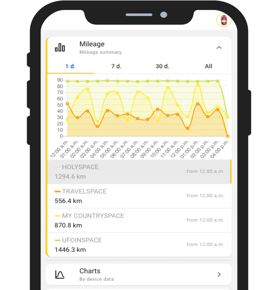
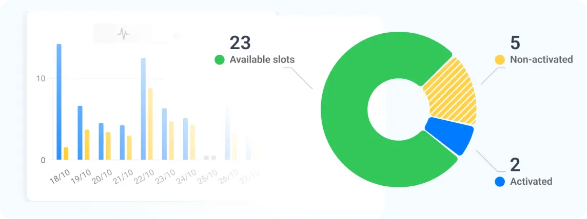
History and Statistics
Generate charts, review historical data, and analyze information to effectively monitor events related to your vehicle usage.
Maintenance Counters
Set mileage limits and receive timely reminders for routine maintenance, ensuring your vehicle remains in peak condition.
Detailed Trips Info
Comprehensive reports for each trip, featuring charts, fuel usage calculations, and a complete timeline of events for the desired time period.
Ready to Collaborate?
Offer efficient vehicle and asset tracking services with our GPS tracking tools
Start your 30-day trialGPS Tracking Solutions
Forguard
A versatile GPS tracking application that helps monitor vehicle locations in real time. Whether you're a service provider offering tracking to customers or a business monitoring your own vehicles, Forguard provides essential tools for location tracking and trip analysis.
-
 Intuitive Interface
-
Real-Time Tracking
-
Multilingual Capability
-
Customizable Alerts
-
Detailed Reporting
-
Cross-Platform App (iOS, Android, Web)
Tags
A comprehensive solution for tracking a wide range of assets, from vehicles and equipment to cargo and even workers. Asset Tracking offers the flexibility to monitor any asset type without the need for separate systems.
-
Real-Time Tracking
-
Geofencing Capabilities
-
Analytics & Reporting
-
BLE Technology
-
Asset Grouping
What our Dealers say
The program is beautiful, easy and smooth for customers and is available in several languages. This is what customers really want, as it provides them with all the benefits and services in light of the competition between companies.
We switched to Forguard and this was quite simple. The software is easy to use and also for our clients. Easy to connect trackers and that is very important.
A tracking system that provides all the important uses in managing a vehicle fleet in a convenient and professional manner. The APP looks the same as the web.
Blog about GPS software, hardware and more
Trusted By Leading Tracker Manufacturers


